It's been a while since I've posted anything.
Here's a quick video on a stove that's stood the test of time, the MSR Dragonfly. Notice that during the priming of the stove, there is no "fireball". It takes some practice, but it is possible to prime a white gas stove without a fireball, particularly on a nice stove like the Dragon fly with it's really fine valve control.
Wednesday, February 3, 2016

Sunday, July 19, 2015
Updated Lake Fire Closure Map
This post contains information regarding Forest Closure orders in and around the San Gorgonio Wilderness due to the 2015 Lake Fire.
UPDATES as of 02 May 2017: The PCT is open through the Lake Fire Closure area, however, overnight camping is prohibited.
The Forest Service has issued a map, showing the closure area (see below) and what "recreational opportunities" are currently open (open trails are shown with red dashed lines). The map is a little hard to read, and it's a little hard to tell what's in and what's out of the closure area.
Because the above map from the USFS is a little hard to read, I've gone ahead and drawn out the boundaries of the updated Lake Fire closure area on a topo map (immediately below), or you can open the updated Lake Fire closure area map in a separate window. Hopefully, with my map, you can tell which of your favorite peaks and places are in vs. out of the fire closure.
Note that the boundaries I have drawn are approximate. I say approximate because I've drawn the boundaries free hand just based on the USFS map I haven't followed any detailed written legal descriptions of the closure. That said, I think the boundaries I've drawn convey the sense of the closure. If you're on a trail I've shown outside the closure, I don't think you have to worry about getting hassled by the authorities. I have however placed the text of the closure order in Appendix II, below, if there is any question as to what is or is not within the closure area.
While I wish that the Lake Fire had never occurred, I hail this good news from the Forest Service and salute this common sense approach. There simply was no valid reason to keep the southern portions of the San Gorgonio Wilderness closed; the fire never touched them.
I also greatly appreciate that the Forest Service has made a special "carve out" inside the closure boundaries such that San Gorgonio Mountain, one of the most popular peaks in Southern California, is now open to hikers.
Pacific Crest Trail (PCT) hikers take note: The PCT is open throughout the entire closure area but you may not camp over night within the Lake Fire closure area. The closure extends from one mile west of the San Gorgonio Wilderness boundary, roughly mile 237, to Onyx Summit, roughly mile 252. See map in Appendix I, below.
Errata: Be aware that the lower section of the Falls Creek Trail, 1E04, is shown as open on the official USFS map, shown above. This is an error. The trail was closed about 50 years ago during the 1960's because of private property issues. The lower part of the trail was destroyed and no longer exists when a series of houses were built. If you go to the Momyer Creek Trailhead looking for the lower Falls Creek Trail, you simply won't find it. The USFS map is correct in that the trail is outside the closure area but incorrect inasmuch as it implies that the lower Falls Creek Trail exists in the position shown as an open, official trail.
HJ
Appendix I - A Second Lake Fire Closure Order Map - What is Closed.
Appendix II - Text of the Revised Lake Fire Closure Order
SAN BERNARDINO NATIONAL FOREST
Forest Order No. 05-12-51-15-04
Lake Fire Closure
Pursuant to 16 USC 551 and 36 CFR 261.50(a) and (b), to provide for public safety and protect natural resources, the following acts are prohibited within the Mountaintop and Front Country Ranger Districts of the San Bernardino National Forest. This Order is effective from July 16, 2015 through July 15, 2016.
1. Going into or being upon National Forest System lands within the Lake Fire Closure Area. The Lake Fire Closure Area boundary begins at the intersection of the Santa Ana River Trail (Forest Trail No. 2E03) and State Highway (SH) 38, then continues east along SH 38 to its intersection with Jenks Lake Road, then continues west along the south side of Jenks Lake Road to its intersection with the east fork of Barton’s Creek, then continues south by southeast along the south and east side of Forest Trail Nos. 1E16 and 1E06 to its intersection with Forest Trail No. 1E04, then continues northeast to east along the north side of Forest Trail No. 1E04 to its intersection with Forest Trail No 1W07, then continues east along the north side of Forest Trail No 1W07 to its intersection with San Gogornio Mountain, then continues southeast west of Forest Trail No 1W07 around San Gogornio Peak, then continues south along the section line between Sections 12 and 13, Township 1 South, Range 1 East, San Bernardino Base and Meridian (SBB&M), and Sections 7 and 18, Township 1 South, Range 2 East, SBB&M, then continues east along the southern section line of Sections 18, 17, 16, 15, 14, 13; in Township 1 South, Range 2 East, MDB&M, to its intersection with the Forest boundary, then continues north and east along the Forest Boundary to its intersection with the southern section line of Section 34, Township 2 North, Range 3 East, SBB&M, then continues northwest along Heartbreak Ridge to its intersection with the western section line of Section 32, Township 2 North, Range 3 East, SBB&M, then continues south along the western section line of Section 32, Township 2 North, Range 3 East, and Section 5, Township 1 North, Range 3 East, SBB&M, to its intersection with Onyx Peak, then continues west along the northern section line of Section 7, Township 1 North, Range 3 East, SBB&M, to its intersection with the west side of the Pacific Crest Trail, then continues in a southerly and southwestern direction along the west side of the Pacific Crest Trail to its intersection with Forest Road No. 1N37, then continues northwesterly on the north side of Forest Road No. 1N37 to the intersection with the Santa Ana River Trail, then continues westerly along the north side of the Santa Ana River Trail back to the starting point, as shown on the attached map. 36 CFR 261.53(e).
2. Being on any National Forest System trail within the Lake Fire Closure Area, as shown on the attached map. 36 CFR 261.55(a).
3. Being on any National Forest System road within the Lake Fire Closure Area, as shown on the attached map. 36 CFR 261.54(e).
Pursuant to 36 CFR 261.50(e), the following persons are exempt from this Order:
1. Any Federal, State or local officer, or member of an organized rescue or fire fighting force in the performance of an official duty.
2. Persons with a permit from the Forest Service specifically authorizing the otherwise prohibited act or omission.
3. Owners or lessees of private land within the Lake Fire Closure Area, to the extent necessary to gain access to their land.
These prohibitions are in addition to the general prohibitions in 36 CFR Part 261, Subpart A.
A violation of these prohibitions is punishable by a fine of not more than $5000 for an individual or $10,000 for an organization or imprisonment for not more than six months, or both 16 USC 551 and 18 USC 3559, 3571, and 3581.
Executed in San Bernardino, California, this 16th day of July, 2015
/s/ JODY NOIRON
Forest Supervisor
San Bernardino National Forest
UPDATES as of 02 May 2017: The PCT is open through the Lake Fire Closure area, however, overnight camping is prohibited.
 |
| High Creek Falls, just off the Vivian Creek Trail in the San Gorgonio Wilderness. This area is now OPEN to hiking as of 7/16/2015 |
 |
| Official USFS Lake Fire Closure Area map as of 16 July 2015. The red dashed lines are trails that are open. |
Note that the boundaries I have drawn are approximate. I say approximate because I've drawn the boundaries free hand just based on the USFS map I haven't followed any detailed written legal descriptions of the closure. That said, I think the boundaries I've drawn convey the sense of the closure. If you're on a trail I've shown outside the closure, I don't think you have to worry about getting hassled by the authorities. I have however placed the text of the closure order in Appendix II, below, if there is any question as to what is or is not within the closure area.
While I wish that the Lake Fire had never occurred, I hail this good news from the Forest Service and salute this common sense approach. There simply was no valid reason to keep the southern portions of the San Gorgonio Wilderness closed; the fire never touched them.
I also greatly appreciate that the Forest Service has made a special "carve out" inside the closure boundaries such that San Gorgonio Mountain, one of the most popular peaks in Southern California, is now open to hikers.
Pacific Crest Trail (PCT) hikers take note: The PCT is open throughout the entire closure area but you may not camp over night within the Lake Fire closure area. The closure extends from one mile west of the San Gorgonio Wilderness boundary, roughly mile 237, to Onyx Summit, roughly mile 252. See map in Appendix I, below.
Errata: Be aware that the lower section of the Falls Creek Trail, 1E04, is shown as open on the official USFS map, shown above. This is an error. The trail was closed about 50 years ago during the 1960's because of private property issues. The lower part of the trail was destroyed and no longer exists when a series of houses were built. If you go to the Momyer Creek Trailhead looking for the lower Falls Creek Trail, you simply won't find it. The USFS map is correct in that the trail is outside the closure area but incorrect inasmuch as it implies that the lower Falls Creek Trail exists in the position shown as an open, official trail.
HJ
Appendix I - A Second Lake Fire Closure Order Map - What is Closed.
 |
| This USFS map is the opposite of the first map. This map shows trails and roads that are closed. Note however that the PCT is open throughout it's length for hiking. |
Appendix II - Text of the Revised Lake Fire Closure Order
SAN BERNARDINO NATIONAL FOREST
Forest Order No. 05-12-51-15-04
Lake Fire Closure
Pursuant to 16 USC 551 and 36 CFR 261.50(a) and (b), to provide for public safety and protect natural resources, the following acts are prohibited within the Mountaintop and Front Country Ranger Districts of the San Bernardino National Forest. This Order is effective from July 16, 2015 through July 15, 2016.
1. Going into or being upon National Forest System lands within the Lake Fire Closure Area. The Lake Fire Closure Area boundary begins at the intersection of the Santa Ana River Trail (Forest Trail No. 2E03) and State Highway (SH) 38, then continues east along SH 38 to its intersection with Jenks Lake Road, then continues west along the south side of Jenks Lake Road to its intersection with the east fork of Barton’s Creek, then continues south by southeast along the south and east side of Forest Trail Nos. 1E16 and 1E06 to its intersection with Forest Trail No. 1E04, then continues northeast to east along the north side of Forest Trail No. 1E04 to its intersection with Forest Trail No 1W07, then continues east along the north side of Forest Trail No 1W07 to its intersection with San Gogornio Mountain, then continues southeast west of Forest Trail No 1W07 around San Gogornio Peak, then continues south along the section line between Sections 12 and 13, Township 1 South, Range 1 East, San Bernardino Base and Meridian (SBB&M), and Sections 7 and 18, Township 1 South, Range 2 East, SBB&M, then continues east along the southern section line of Sections 18, 17, 16, 15, 14, 13; in Township 1 South, Range 2 East, MDB&M, to its intersection with the Forest boundary, then continues north and east along the Forest Boundary to its intersection with the southern section line of Section 34, Township 2 North, Range 3 East, SBB&M, then continues northwest along Heartbreak Ridge to its intersection with the western section line of Section 32, Township 2 North, Range 3 East, SBB&M, then continues south along the western section line of Section 32, Township 2 North, Range 3 East, and Section 5, Township 1 North, Range 3 East, SBB&M, to its intersection with Onyx Peak, then continues west along the northern section line of Section 7, Township 1 North, Range 3 East, SBB&M, to its intersection with the west side of the Pacific Crest Trail, then continues in a southerly and southwestern direction along the west side of the Pacific Crest Trail to its intersection with Forest Road No. 1N37, then continues northwesterly on the north side of Forest Road No. 1N37 to the intersection with the Santa Ana River Trail, then continues westerly along the north side of the Santa Ana River Trail back to the starting point, as shown on the attached map. 36 CFR 261.53(e).
2. Being on any National Forest System trail within the Lake Fire Closure Area, as shown on the attached map. 36 CFR 261.55(a).
3. Being on any National Forest System road within the Lake Fire Closure Area, as shown on the attached map. 36 CFR 261.54(e).
Pursuant to 36 CFR 261.50(e), the following persons are exempt from this Order:
1. Any Federal, State or local officer, or member of an organized rescue or fire fighting force in the performance of an official duty.
2. Persons with a permit from the Forest Service specifically authorizing the otherwise prohibited act or omission.
3. Owners or lessees of private land within the Lake Fire Closure Area, to the extent necessary to gain access to their land.
These prohibitions are in addition to the general prohibitions in 36 CFR Part 261, Subpart A.
A violation of these prohibitions is punishable by a fine of not more than $5000 for an individual or $10,000 for an organization or imprisonment for not more than six months, or both 16 USC 551 and 18 USC 3559, 3571, and 3581.
Executed in San Bernardino, California, this 16th day of July, 2015
/s/ JODY NOIRON
Forest Supervisor
San Bernardino National Forest
Monday, June 29, 2015
Southern California Peaks Over 9000 Feet (2743 Meters)
I recently read on Adventure 16's website that "at roughly 9,400’, Mt. Baden-Powell is the fourth highest peak in Southern California...". Um, no. Not even close. By my count, Mt. Baden-Powell is the 37th highest peak in Southern California.
Now, don't get me wrong, I like Adventure 16, and I like that they're encouraging people to hike. But Baden-Powell just isn't the fourth highest peak in Southern California. I don't even know where they'd get that from. I mean, what?? It isn't even the fourth highest in its own range, the San Gabriel Mountains; it's sixth after Mt. Harwood.
UPDATE 16 July 2015: Many peaks in and near the San Gorgonio Wilderness are currently closed due to the Lake Fire. See Lake Fire Closure Map for details.
OK, so what are the highest peaks in Southern California? Well, it depends on your definition of peak, but here's my list of summits generally called peaks in Southern California that are over 9000 feet (2743 meters) in elevation. I'll add some notes at the bottom. My list isn't perfect. If you think I've left something off, mention it in the comments below.
To go along with my list I've created a topo map of Southern California Peaks Over 9000 Feet (2743 Meters). You can view the map in-line below or you can open Topo Map of Southern California Peaks Over 9000 Feet (2743 Meters) in a separate window.
Southern California Peaks Over 9000 Feet (2743 Meters)
(Ordered by height)
Notes
1. What is "Southern" California? For these purposes, I consider Southern California to be the area comprised of the following ten counties:
2. What is a peak? I'm including peaks that are generally recognized as peaks. By that I mean there is a name commonly associated with a particular summit. There is no general agreement as to exactly what constitutes a peak. For these purposes, a peak has to have at least two closed 40' contour lines (80 feet total) and preferably three closed 40' contour lines (120 feet total) before it can even begin to be called a peak. And I'm being pretty liberal. Some definitions of "peak" require six closed contour lines. The only exception to my "must have at least two closed contour lines" rule is if there is a USGS peak name. If the USGS marks it as a peak, then I include it on my list regardless of how many closed contour lines there are. I'm sure some people would argue that particular peaks on my list should be deleted and that other peaks should be added. If you're one of those people, then feel free to leave a comment in the comments section below. I may or may not add/delete your favorite peak, but I've got an open mind.
3. What do I mean by "source?" Well, if a peak has a name on the maps produced by the United States Geological Survey, I so indicate with the initialism, "USGS". If the peak is listed in the Hundred Peaks Section list, I so indicate with the initialism, "HPS". If a peak has a name that is just a name of common use, i.e. no body or organization has conferred said name, then I simply put "Common Use". Notice that a few sources are listed as "colloquial". The "colloquial" designation means that some people may refer to a certain summit as a peak but that it's far from commonly accepted as a peak. In time, these may become commonly accepted names, but for now I list these simply for ease of reference.
4. Where do I get my elevations from? Well, if a specific height is listed on a USGS map, I use that height. If not, then I use the highest contour interval below the named summit. Of course the summit is actually higher, but since I don't know how much higher, I just use the closest contour interval. in such cases, I indicate the elevation with a plus symbol (+) next to it. In some cases, I am aware of more accurate heights than what is listed on the USGS topo maps. In particular, North American Vertical Datum of 1988 (NAVD88) elevations are used whenever they are available.
5. Why do I use the name Landells Peak instead of Luella Todd Peak? Well, both names have some claim to this summit, but a) Mr. Landells had a long association with the San Jacinto Mountains whereas Ms. Todd to my knowledge did not and b) Mr. Landells died while trying to rescue someone. I think the manner of Mr. Landells death and his long association with the San Jacintos give him the better claim to this peak. Ms. Todd was a noteworthy individual and should have a peak named in her honor, but not this peak in my opinion. Feel free to disagree of course.
6. With respect to Marion Mountain, there is a spot height of 10,362 feet marked on the easternmost summit. Of course when you actually climb Marion Mountain you realize that the highest point on the mountain is the westernmost summit. The USGS unfortunately did not list a spot height for this point. I therefore list what I have available to me, but be aware that the actual height of Marion Mountain is greater than 10,362 feet. See also: Is Marion Mountain "Wrong" on the USGS Map?
7. Why don't I include West Galena Peak? Well, there are three very closely clustered high points atop Galena Peak, all of about the same height. Those points just aren't far enough apart to be called separate peaks.
8. Why do I place Fish Creek Peak where I do (on Ten Thousand Foot Ridge)? Some people place Fish Creek Peak over on the eastern flank of Lake Peak, but the point they mark, elevation 9942, doesn't even have one closed contour line. FAIL! This is just not a peak. I mark Fish Creek Peak over on Ten Thousand Foot Ridge where it belongs.
I hope you find this list useful,
HJ
Now, don't get me wrong, I like Adventure 16, and I like that they're encouraging people to hike. But Baden-Powell just isn't the fourth highest peak in Southern California. I don't even know where they'd get that from. I mean, what?? It isn't even the fourth highest in its own range, the San Gabriel Mountains; it's sixth after Mt. Harwood.
UPDATE 16 July 2015: Many peaks in and near the San Gorgonio Wilderness are currently closed due to the Lake Fire. See Lake Fire Closure Map for details.
 |
| San Jacinto Peak, 6th highest peak in Southern California |
 |
| Summit sign atop Mt Baldy (Mt San Antonio), 26th highest peak in Southern California |
Southern California Peaks Over 9000 Feet (2743 Meters)
(Ordered by height)
| Rank | Peak Name | Elevation | Range | Source |
| 1 | San Gorgonio Mtn | 11,502 | San Bernardinos | USGS |
| 2 | Jepson Peak | 11,205 | San Bernardinos | USGS |
| 3 | Bighorn Mountain | 10,997 | San Bernardinos | HPS |
| 4 | Dragons Head Pk | 10,866 | San Bernardinos | HPS |
| 5 | Anderson Peak | 10,840+ | San Bernardinos | USGS |
| 6 | San Jacinto Peak | 10,834 | San Jacintos | USGS |
| 7 | Charlton Peak | 10,806 | San Bernardinos | USGS |
| 8 | Little Charlton Peak | 10,696 | San Bernardinos | USGS |
| 9 | East San Bernardino Peak | 10,691 | San Bernardinos | USGS |
| 10 | Shields Peak | 10,680+ | San Bernardinos | USGS |
| 11 | Jean Peak | 10,670 | San Jacintos | USGS |
| 12 | San Bernardino Peak | 10,649 | San Bernardinos | USGS |
| 13 | Alto Diablo Peak | 10,563 | San Bernardinos | Common Use |
| 14 | East Dobbs Peak | 10,520+ | San Bernardinos | Common Use |
| 15 | Folly Peak | 10,480+ | San Jacintos | USGS |
| 16 | West Dobbs Peak | 10,459 | San Bernardinos | USGS |
| 17 | Miller Peak | 10,400+ | San Jacintos | USGS |
| 18 | Shirley Peak | 10,388 | San Jacintos | Common Use |
| 19 | Marion Mountain | 10,362 | San Jacintos | USGS |
| 20 | Grinnell Mtn | 10,284 | San Bernardinos | USGS |
| 21 | Pi Peak (3.141 km elevation) | 10,280+ | San Bernardinos | Colloquial |
| 22 | Lake Peak | 10,161 | San Bernardinos | USGS |
| 23 | Newton Drury Peak | 10,160+ | San Jacintos | USGS |
| 24 | Joyce Pk | 10,160+ | San Jacintos | Colloquial |
| 25 | Mt Ellen (aka Mt St Ellens) | 10,160+ | San Jacintos | Colloquial |
| 26 | Ten Thousand Foot Ridge | 10,094 | San Bernardinos | HPS |
| 27 | Mt San Antonio (aka Mt Baldy) | 10,064 | San Gabriels | USGS |
| 28 | Zahniser Peak | 10,056 | San Bernardinos | Common Use |
| 29 | N Fork Peak | 10,040+ | San Bernardinos | Colloquial |
| 30 | West Baldy | 9988 | San Gabriels | Common Use |
| 31 | Fish Creek Pk | 9971 | San Bernardinos | Colloquial |
| 32 | Sugarloaf Mtn | 9952 | San Bernardinos | USGS |
| 33 | Hell For Sure Pk | 9930 | San Bernardinos | Common Use |
| 34 | Tea Can Pk (aka Tea Bag Can Pk) | 9884 | San Bernardinos | Common Use |
| 35 | Green Mtn | 9775 | San Bernardinos | Colloquial |
| 36 | Cornell Peak | 9750 | San Jacintos | USGS |
| 37 | Pine Mtn | 9648 | San Gabriels | USGS |
| 38 | Mission Peak | 9580 | San Bernardinos | Colloquial |
| 39 | Dawson Pk | 9575 | San Gabriels | USGS |
| 40 | Mt Harwood | 9552 | San Gabriels | USGS |
| 41 | Harvard Peak | 9520+ | San Jacintos | USGS |
| 42 | Whitewater Mountain | 9480+ | San Bernardinos | Colloquial |
| 43 | Lightning Gulch Point | 9465 | San Bernardinos | Colloquial |
| 44 | Brown Peak | 9400+ | San Jacintos | Colloquial |
| 45 | Mt Baden-Powell | 9399 | San Gabriels | USGS |
| 46 | Wildhorse Mtn | 9385 | San Bernardinos | Colloquial |
| 47 | Yale Peak | 9360+ | San Jacintos | Common Use |
| 48 | Landells Peak (aka Luella Todd Pk) | 9356 | San Jacintos | California State Park Service |
| 49 | Lost Peak | 9327 | San Bernardinos | Colloquial |
| 50 | Galena Peak | 9324 | San Bernardinos | USGS |
| 51 | Kristen Pk | 9204 | San Jacintos | Common Use |
| 52 | Divide Peak | 9200+ | San Jacintos | California State Park Service |
| 53 | Jumpoff Peak | 9200+ | San Bernardinos | Colloquial |
| 54 | Mill Peak | 9164 | San Bernardinos | Colloquial |
| 55 | Seca Mtn | 9156 | San Bernardinos | Colloquial |
| 56 | Cienega Peak | 9144 | San Jacintos | Common Use |
| 57 | Throop Pk | 9138 | San Gabriels | USGS |
| 58 | Little San Gorgonio Pk | 9133 | San Bernardinos | USGS |
| 59 | Sugarcube Pk | 9123 | San Bernardinos | Colloquial |
| 60 | Onyx Peak | 9113 | San Bernardinos | USGS |
| 61 | Triple Divide Mtn | 9070 | San Bernardinos | Colloquial |
| 62 | Wanat Peak | 9000+ | San Bernardinos | Colloquial |
 |
| Sugarloaf Mountain, 29th highest peak in Southern California |
1. What is "Southern" California? For these purposes, I consider Southern California to be the area comprised of the following ten counties:
- San Luis Obispo
- Kern
- Santa Barbara
- Ventura
- Los Angeles
- San Bernardino
- Orange
- Riverside
- San Diego
- Imperial
2. What is a peak? I'm including peaks that are generally recognized as peaks. By that I mean there is a name commonly associated with a particular summit. There is no general agreement as to exactly what constitutes a peak. For these purposes, a peak has to have at least two closed 40' contour lines (80 feet total) and preferably three closed 40' contour lines (120 feet total) before it can even begin to be called a peak. And I'm being pretty liberal. Some definitions of "peak" require six closed contour lines. The only exception to my "must have at least two closed contour lines" rule is if there is a USGS peak name. If the USGS marks it as a peak, then I include it on my list regardless of how many closed contour lines there are. I'm sure some people would argue that particular peaks on my list should be deleted and that other peaks should be added. If you're one of those people, then feel free to leave a comment in the comments section below. I may or may not add/delete your favorite peak, but I've got an open mind.
3. What do I mean by "source?" Well, if a peak has a name on the maps produced by the United States Geological Survey, I so indicate with the initialism, "USGS". If the peak is listed in the Hundred Peaks Section list, I so indicate with the initialism, "HPS". If a peak has a name that is just a name of common use, i.e. no body or organization has conferred said name, then I simply put "Common Use". Notice that a few sources are listed as "colloquial". The "colloquial" designation means that some people may refer to a certain summit as a peak but that it's far from commonly accepted as a peak. In time, these may become commonly accepted names, but for now I list these simply for ease of reference.
4. Where do I get my elevations from? Well, if a specific height is listed on a USGS map, I use that height. If not, then I use the highest contour interval below the named summit. Of course the summit is actually higher, but since I don't know how much higher, I just use the closest contour interval. in such cases, I indicate the elevation with a plus symbol (+) next to it. In some cases, I am aware of more accurate heights than what is listed on the USGS topo maps. In particular, North American Vertical Datum of 1988 (NAVD88) elevations are used whenever they are available.
5. Why do I use the name Landells Peak instead of Luella Todd Peak? Well, both names have some claim to this summit, but a) Mr. Landells had a long association with the San Jacinto Mountains whereas Ms. Todd to my knowledge did not and b) Mr. Landells died while trying to rescue someone. I think the manner of Mr. Landells death and his long association with the San Jacintos give him the better claim to this peak. Ms. Todd was a noteworthy individual and should have a peak named in her honor, but not this peak in my opinion. Feel free to disagree of course.
6. With respect to Marion Mountain, there is a spot height of 10,362 feet marked on the easternmost summit. Of course when you actually climb Marion Mountain you realize that the highest point on the mountain is the westernmost summit. The USGS unfortunately did not list a spot height for this point. I therefore list what I have available to me, but be aware that the actual height of Marion Mountain is greater than 10,362 feet. See also: Is Marion Mountain "Wrong" on the USGS Map?
7. Why don't I include West Galena Peak? Well, there are three very closely clustered high points atop Galena Peak, all of about the same height. Those points just aren't far enough apart to be called separate peaks.
8. Why do I place Fish Creek Peak where I do (on Ten Thousand Foot Ridge)? Some people place Fish Creek Peak over on the eastern flank of Lake Peak, but the point they mark, elevation 9942, doesn't even have one closed contour line. FAIL! This is just not a peak. I mark Fish Creek Peak over on Ten Thousand Foot Ridge where it belongs.
 |
| San Jacinto Peak, 6th highest peak in Southern California |
I hope you find this list useful,
HJ
 |
| San Gorgonio Mountain, highest peak in Southern California |
Friday, June 19, 2015
Lake Fire – San Gorgonio Wilderness
UPDATE 16 July 2015: Many areas in and near the San Gorgonio Wilderness are currently closed due to the Lake Fire, but the Forest Service has opened much of the southern portion of the wilderness (which did not burn). See Updated Lake Fire Closure Map for details.
It is with deep regret that I must announce that the San Gorgonio Wilderness currently has a large fire burning in it, the Lake Fire. The entire wilderness is closed. All wilderness permits are cancelled. If you have camping reservations that you have paid for, my information is that you should contact the issuer of the reservation for a refund.
Updates, 6/26/2015, 0800 Hours
A new fire perimeter map has been issued. There is a lot of fire grown in the East Northeast sector of the fire; this is outside the San Gorgonio Wilderness. The good news for the San Gorgonio Wilderness is that the fire within the wilderness did not significantly penetrate new areas. However, MODIS thermal (i.e. heat) sensing indicates a lot of active burning in the N Fork of the Whitewater River area. MODIS also indicates buring in the vicinity of High Meadow Springs. I continue to hold out hope that High Meadow Springs, a very lovely area that I've camped at multiple times, will not burn. For MODIS information, refer to the interactive maps, below (several paragraphs down). Areas of active burn are indicated by red dots. MODIS data is not particularly precise, so don't freak out if you see a red dot in an area far outside the perimeter. I'll put an excerpt of plotted MODIS data below this morning's perimeter map. The excerpt is just for the N Fork Whitewater River area and vicinity.
More good news: No further burning on the flanks of San Gorgonio Mountain is indicated. It would be a true shame if the krumholtz forest (pines dwarfed by harsh conditions at high elevation) atop the high peaks of the San Gorgonio were to burn. It would take centuries upon centuries for such a fragile high elevation forest to regenerate.
Updates, 6/25/2015, 2300 Hours
No map updates have been issued, but the Lake Fire has now grown to 25,599 acres (yipes!) and containment has shrunk to 19%. Containment was up around 40% a couple of days ago, but wind direction changed and the fire turned sharply north. 7,390 structures are considered threatened, but no structures have been lost.
Even though no map updates have been issued, MODIS thermal (i.e. heat) imaging is up to date and one can see that activity has decreased in the N. Fork of the Whitewater area, but there is still a lot of activity. It looks like Lake Peak has completely burned over which is a real shame because it was really beautiful on top, deeply forested.
To the north, the fire has really mushroomed and spread. The north eastern sector of the fire may turn out to be as large or larger than the original fire sector in the San Gorgonio Wilderness.
Updates, 6/25/2015, 0600 Hours
1. The Lake Fire has now burned the east flanks of San Gorgonio Mountain. The Sky High Trail has been burned over in multiple spots. The fire has also burned up to about 10,000 feet on the east flank of Bighorn Mountain. It's a sad day for San Gorgonio Wilderness lovers.
2. The fire has also advanced considerably to the north overnight and has now burned into Pipes Canyon.
Updates, 6/24/2015, 1800 Hours
1. The Lake Fire today made a dramatic end run around containment lines and burned about three miles to the north. Camp Oakes on the north side of Onyx Summit was evacuated. This is a very serious development. KML files have not been posted to the public server, so I'll add a static map here. The fire also burned more of the North Fork of the Whitewater River and Hell-For-Sure drainages. I looks like it also moved a little bit further down the South Fork of Mission Creek. I've placed blue rectangles on the map below that indicate areas where the fire is growing.
2. A Forest Order was issued today that closed the entire San Gorgonio Wilderness and also closed non wilderness areas to the east until October 1, 2015. Closing the entire wilderness, particularly those areas not touched by the fire, seems overly Draconian to me. The closed area is mapped below.
Fire Progression Map of the Lake Fire, 6/24/2015.
Here is a map of the progression of the Lake Fire. Green indicates the oldest burn. Red indicates the newest burn. There's a lot of new burning in the North Fork of the Whitewater River area. Alas, it now appears that Mine Shaft and Big Tree Camps are toast.
The silver lining here is that maybe the long brush choked Big Tree Track (a short cut from Mine Shaft Camp to Big Tree Camp) may become passable again. It might also be possible to venture down the North Fork from Big Tree Camp. Previously, it was darned near impossible to go downstream from Big Tree because the brush was so thick.
Time Lapse Video of the Lake Fire
Topographic Fire Map
An interactive map of the fire is displayed below. You will need to zoom way in to make any sense of it. This is my Interactive San Gorgonio Wilderness Area Map with the Lake Fire burn perimeter shown in gold color cross hatching. I like it because I can see where things are a lot better on a topo.
It's a little cluttered because I have a lot of trails and camps marked. I'll put a clearer image down below if you just want to see the burn area and the topo map.
Trail Camp Status 6/25/2015 (assuming the maps are accurate) from generally west to east:
Jackstraw Springs: OK
Trail Fork Springs: OK
Anderson Flat: Possibly burned (can't tell from map as of 6/24/2015).
Shields Flat: Burned.
High Meadow Springs: Possibly burned (can't tell from map as of 6/24/2015).
Red Rock Flat: Burned.
Dollar Lake: Burned.
Dry Lake View: OK
Grinnell Ridge: Burned. By the look of it, pretty badly (based on photos I've seen).
Dry Lake: Burned.
Lodgepole: Burned.
Trail Flat: Possibly burned (can't tell from map as of 6/24/2015).
Summit: OK, but threatened
Fish Creek Saddle: Burned.
Fish Creek: Burned
Mineshaft Flat: Burned
Big Tree: Burned.
9 trail camps definitely burned.
3 trail camps possibly burned
12 out of a total of 25 trail camps (48%) have burned or have possibly burned.
Note: This represents my best guess based on the available maps.
Trail Status 6/25/2015 (assuming the map is accurate) from generally west to east:
Forsee Creek Trail: Minimal Burning along some of the easternmost switchbacks.
San Bernardino Peak Divide Trail: Burned over in three places.
1. Between Anderson and Shields Flat
2. Near Alto Diablo
3. Most or all of Red Rock Flat
Topo Map Without All the Clutter.
Appendix – US Forest Service PIO Maps
23 June 2015, 1800 Hours. See comments below image.
Comments:
The fire is active on the east side of Ten Thousand Foot Ridge and in the drainage of the North Fork of the Whitewater River. The fire has now crossed the North Fork of the Whitewater River. There is also active burning west of High Meadow Springs and in the Coon Creek drainage.
23 June 2015, 0600 Hours. See comments below image.
The latest PIO fire perimeter map shows growth in the Big Tree area as well as east to the Coon Creek Jump Off area which is consistent with what the MODIS sensors are report. It's hard to tell from the map, but Big Tree Camp may now be toast. The fire is clearly threatening it. It wouldn't bother me in the least to have all the brush in the North Fork of the Whitewater River drainage cleaned out. That is some dense, nasty stuff.
22 June 2015, 0600 Hours. I've highlighted some areas with green rectangles. See comments below image.
Comments on the above highlighted areas from left to right:
1. It looks like there's been a bit more growth on the south side of the divide near Anderson and Shields Flats, but it's been minimal.
2. There's been more burning in the Dry Lake area. The fire has gone up into the "glacial chop country" (the moraine fields west of Dry Lake. It looks like Dry Lake is nearly encircled. This doesn't look good for the Dry Lake and Lodgepole trail camps.
3. The fire on the south side of Ten Thousand Foot Ridge appears to have grown, but only slightly.
4. There's been some growth to the fire on the eastern edge, particularly around Coon Creek Cabin and Coon Creek Jump Off.
General comments: Notice the solid black line on the northern edge of the fireline. It looks like the USFS has a pretty high degree of confidence in the solidity of the fire line in this area.
21 June 2015, 1400 Hours. I'll make comments on the progress of the fire below the map.
I've drawn several rectangles in bright green on the above map. Notes from left to right:
1. You can see that the fire overtopped the main divide of the wilderness between Shields Flat and Anderson Flat. The incursion was relatively limited. The status of High Meadow Springs, Shields Flat and Anderson Flat trail camps is unknown.
2. You can see that Dollar Lake has been overrun by the fire, but it looks as though the fire did not cross the divide.
3. It looks like Lodgepole and Trail Flats Camps were spared, but it's hard to tell from this map. Dry Lake Camp doesn't appear to be shown; its status is unknown.
4. The fire went up toward Fish Creek Saddle and appears to have burned all the way to the saddle. The status of Fish Creek Saddle trail camp is unknown. Part of the west face of Lake peak has also burned in a spot fire. It appears that the summit of Lake Peak did not burn.
5. A fairly large incursion went over Ten Thousand Foot Ridge and into the drainage of the N Fork of the Whitewater river, but it looks like Mineshaft Flat and Big Tree Camps were not affected. I think. It's hard to tell based on this map which is none to clear.
 |
| Lake Fire, San Gorgonio Wilderness, June 2015 |
Updates, 6/26/2015, 0800 Hours
A new fire perimeter map has been issued. There is a lot of fire grown in the East Northeast sector of the fire; this is outside the San Gorgonio Wilderness. The good news for the San Gorgonio Wilderness is that the fire within the wilderness did not significantly penetrate new areas. However, MODIS thermal (i.e. heat) sensing indicates a lot of active burning in the N Fork of the Whitewater River area. MODIS also indicates buring in the vicinity of High Meadow Springs. I continue to hold out hope that High Meadow Springs, a very lovely area that I've camped at multiple times, will not burn. For MODIS information, refer to the interactive maps, below (several paragraphs down). Areas of active burn are indicated by red dots. MODIS data is not particularly precise, so don't freak out if you see a red dot in an area far outside the perimeter. I'll put an excerpt of plotted MODIS data below this morning's perimeter map. The excerpt is just for the N Fork Whitewater River area and vicinity.
More good news: No further burning on the flanks of San Gorgonio Mountain is indicated. It would be a true shame if the krumholtz forest (pines dwarfed by harsh conditions at high elevation) atop the high peaks of the San Gorgonio were to burn. It would take centuries upon centuries for such a fragile high elevation forest to regenerate.
 |
| Lake Fire Perimeter Map, 06/25/2015 0600 hours |
 |
| MODIS data plotted on a 1:24,000 topographic map. Data current as of 0800 on 6/26/2015 There's still a lot of active burning going on. This is far from over. |
Updates, 6/25/2015, 2300 Hours
No map updates have been issued, but the Lake Fire has now grown to 25,599 acres (yipes!) and containment has shrunk to 19%. Containment was up around 40% a couple of days ago, but wind direction changed and the fire turned sharply north. 7,390 structures are considered threatened, but no structures have been lost.
Even though no map updates have been issued, MODIS thermal (i.e. heat) imaging is up to date and one can see that activity has decreased in the N. Fork of the Whitewater area, but there is still a lot of activity. It looks like Lake Peak has completely burned over which is a real shame because it was really beautiful on top, deeply forested.
To the north, the fire has really mushroomed and spread. The north eastern sector of the fire may turn out to be as large or larger than the original fire sector in the San Gorgonio Wilderness.
Updates, 6/25/2015, 0600 Hours
1. The Lake Fire has now burned the east flanks of San Gorgonio Mountain. The Sky High Trail has been burned over in multiple spots. The fire has also burned up to about 10,000 feet on the east flank of Bighorn Mountain. It's a sad day for San Gorgonio Wilderness lovers.
 |
| Lake Fire Perimeter detail, vicinity San Gorgonio Mountain, as of 25 June 2015, 0600 hours. |
 |
| Lake Fire perimeter map, 06/25/2015, 0600 hours. |
Updates, 6/24/2015, 1800 Hours
1. The Lake Fire today made a dramatic end run around containment lines and burned about three miles to the north. Camp Oakes on the north side of Onyx Summit was evacuated. This is a very serious development. KML files have not been posted to the public server, so I'll add a static map here. The fire also burned more of the North Fork of the Whitewater River and Hell-For-Sure drainages. I looks like it also moved a little bit further down the South Fork of Mission Creek. I've placed blue rectangles on the map below that indicate areas where the fire is growing.
 |
| Lake Fire perimeter map as of 6/24/2015, 1800 hours. |
2. A Forest Order was issued today that closed the entire San Gorgonio Wilderness and also closed non wilderness areas to the east until October 1, 2015. Closing the entire wilderness, particularly those areas not touched by the fire, seems overly Draconian to me. The closed area is mapped below.
 |
| Forest Order 05-12-51-15-03, the Lake Fire Closure area. Everything is closed in the SGW, even areas outside the burn. |
Fire Progression Map of the Lake Fire, 6/24/2015.
Here is a map of the progression of the Lake Fire. Green indicates the oldest burn. Red indicates the newest burn. There's a lot of new burning in the North Fork of the Whitewater River area. Alas, it now appears that Mine Shaft and Big Tree Camps are toast.
The silver lining here is that maybe the long brush choked Big Tree Track (a short cut from Mine Shaft Camp to Big Tree Camp) may become passable again. It might also be possible to venture down the North Fork from Big Tree Camp. Previously, it was darned near impossible to go downstream from Big Tree because the brush was so thick.
 |
| Fire Progression Map of the Lake Fire as of 6/24/2015, 0600 hours. Green = oldest; Red = Newest |
Time Lapse Video of the Lake Fire
Topographic Fire Map
An interactive map of the fire is displayed below. You will need to zoom way in to make any sense of it. This is my Interactive San Gorgonio Wilderness Area Map with the Lake Fire burn perimeter shown in gold color cross hatching. I like it because I can see where things are a lot better on a topo.
It's a little cluttered because I have a lot of trails and camps marked. I'll put a clearer image down below if you just want to see the burn area and the topo map.
Trail Camp Status 6/25/2015 (assuming the maps are accurate) from generally west to east:
Jackstraw Springs: OK
Trail Fork Springs: OK
Anderson Flat: Possibly burned (can't tell from map as of 6/24/2015).
Shields Flat: Burned.
High Meadow Springs: Possibly burned (can't tell from map as of 6/24/2015).
Red Rock Flat: Burned.
Dollar Lake: Burned.
Dry Lake View: OK
Grinnell Ridge: Burned. By the look of it, pretty badly (based on photos I've seen).
Dry Lake: Burned.
Lodgepole: Burned.
Trail Flat: Possibly burned (can't tell from map as of 6/24/2015).
Summit: OK, but threatened
Fish Creek Saddle: Burned.
Fish Creek: Burned
Mineshaft Flat: Burned
Big Tree: Burned.
9 trail camps definitely burned.
3 trail camps possibly burned
12 out of a total of 25 trail camps (48%) have burned or have possibly burned.
Note: This represents my best guess based on the available maps.
 |
Red = burned.
Yellow = possibly burned.
Green = unburned.
|
Trail Status 6/25/2015 (assuming the map is accurate) from generally west to east:
Forsee Creek Trail: Minimal Burning along some of the easternmost switchbacks.
San Bernardino Peak Divide Trail: Burned over in three places.
1. Between Anderson and Shields Flat
2. Near Alto Diablo
3. Most or all of Red Rock Flat
South Fork Trail: Burned.
Dollar Lake Trail: Burned all the way to Dollar Lake Saddle.
Dry Lake Trail: Burned up to and past Dry Lake. Trail Flat might not have burned (yet).
Santa Ana River Trail: Burned along much of its route from vicinity South Fork Campground east to the Heart Bar area.
Lost Creek Trail: Burned.
Fish Creek Saddle Trail (from Lodgepole Spring): Burned.
Fish Creek Trail: Burned.
Sky High Trail: Burned. The fire has now crossed the Sky High Trail in multiple places.
North Fork Meadows Trail: Burned (majority)
Pacific Crest Trail (PCT): Burned over a ~six mile stretch to the east of the San Gorgonio Wilderness
Pacific Crest Trail (PCT): Burned over a ~six mile stretch to the east of the San Gorgonio Wilderness
Yes, I know the PCT is outside the wilderness, but it's an important trail. Same with the Santa Ana River Trail.
Topo Map Without All the Clutter.
So, maybe you don't want to see all of my trail camp, trail, etc. markings. Here's a hopefully clearer map using Gmap4 which is maintained by Joseph Elfelt. You can also open this map in a separate page. The green line is the San Gorgonio Wilderness Boundary. The bright red dots indicate that MODIS (satellite based infrared) thermal sensors are picking up heat. They are NOT very precise, but they do indicate fire activity somewhere in the general vicinity.
HJ
Appendix – US Forest Service PIO Maps
23 June 2015, 1800 Hours. See comments below image.
 |
| Lake Fire Perimeter Map as of 1800 hours 23 June 2015 |
The fire is active on the east side of Ten Thousand Foot Ridge and in the drainage of the North Fork of the Whitewater River. The fire has now crossed the North Fork of the Whitewater River. There is also active burning west of High Meadow Springs and in the Coon Creek drainage.
23 June 2015, 0600 Hours. See comments below image.
 |
| Lake Fire Perimeter Map as of 0600 hours 23 June 2015 |
22 June 2015, 0600 Hours. I've highlighted some areas with green rectangles. See comments below image.
 |
| Lake Fire Perimeter Map as of 0600 hours 22 June 2015 |
1. It looks like there's been a bit more growth on the south side of the divide near Anderson and Shields Flats, but it's been minimal.
2. There's been more burning in the Dry Lake area. The fire has gone up into the "glacial chop country" (the moraine fields west of Dry Lake. It looks like Dry Lake is nearly encircled. This doesn't look good for the Dry Lake and Lodgepole trail camps.
3. The fire on the south side of Ten Thousand Foot Ridge appears to have grown, but only slightly.
4. There's been some growth to the fire on the eastern edge, particularly around Coon Creek Cabin and Coon Creek Jump Off.
General comments: Notice the solid black line on the northern edge of the fireline. It looks like the USFS has a pretty high degree of confidence in the solidity of the fire line in this area.
21 June 2015, 1400 Hours. I'll make comments on the progress of the fire below the map.
 |
| Lake Fire Perimeter Map as of 1400 hours 21 June 2015 |
1. You can see that the fire overtopped the main divide of the wilderness between Shields Flat and Anderson Flat. The incursion was relatively limited. The status of High Meadow Springs, Shields Flat and Anderson Flat trail camps is unknown.
2. You can see that Dollar Lake has been overrun by the fire, but it looks as though the fire did not cross the divide.
3. It looks like Lodgepole and Trail Flats Camps were spared, but it's hard to tell from this map. Dry Lake Camp doesn't appear to be shown; its status is unknown.
4. The fire went up toward Fish Creek Saddle and appears to have burned all the way to the saddle. The status of Fish Creek Saddle trail camp is unknown. Part of the west face of Lake peak has also burned in a spot fire. It appears that the summit of Lake Peak did not burn.
5. A fairly large incursion went over Ten Thousand Foot Ridge and into the drainage of the N Fork of the Whitewater river, but it looks like Mineshaft Flat and Big Tree Camps were not affected. I think. It's hard to tell based on this map which is none to clear.
Sunday, May 31, 2015
Proportional Total Pack Weight
Let's talk about pack weight. There are three types of weight that are most frequently talked about: Base weight, consumables weight, and total pack weight. You'll also hear about "skin out" weight which is the weight of everything but your birthday suit. Skin out weight is a little harder to calculate and work with, particularly for those who like to "weigh in" at the trailhead, so I'm just going to focus on the more common ways to look at pack weight: base weight, consumables weight, and total pack weight. Here are my explanations:
- Base Weight. This is the weight of things that don't vary with the length of a trip. For example, my sleeping bag weighs 1.3 lbs whether I take a 3 day trip or a 7 day trip.
- Consumables Weight. Typically food, fuel, and water. Taking the example of a 3 day vs. a 7 day trip, if I carry about 2 lbs of food per day, then for a 3 day trip, I'd carry 6 lbs of food whereas for a 7 day trip, I'd carry 14.
- Total Pack Weight. Total pack weight is the sum of your base weight + your consumables weight and is sometimes referred to as just "pack weight."
Now, the tendency is for hikers to focus on their base weight. Consumables weight is after all a function of how long a trip is rather than good gear planning. I mean you have to eat, so long as you're not carrying excessive amounts of food per day, there's not much you can do to reduce weight (short of someone hiking in supplies to you or you hiking out for supplies). If you carry X pounds of food per day and hike Y days, then your weight is X times Y, and you're pretty much stuck with it. So base weight, which is not dictated by the length of the trip, makes a lot of sense to focus on.
But total pack weight still matters. I mean there's an upper limit to what a given human being can carry. Go past certain limits, and you get into the "suffering zone." We're out there to enjoy this right? I just gave up my vacation to go backpacking because it's going to be fun, remember? If it's not fun, then just why am I doing it?
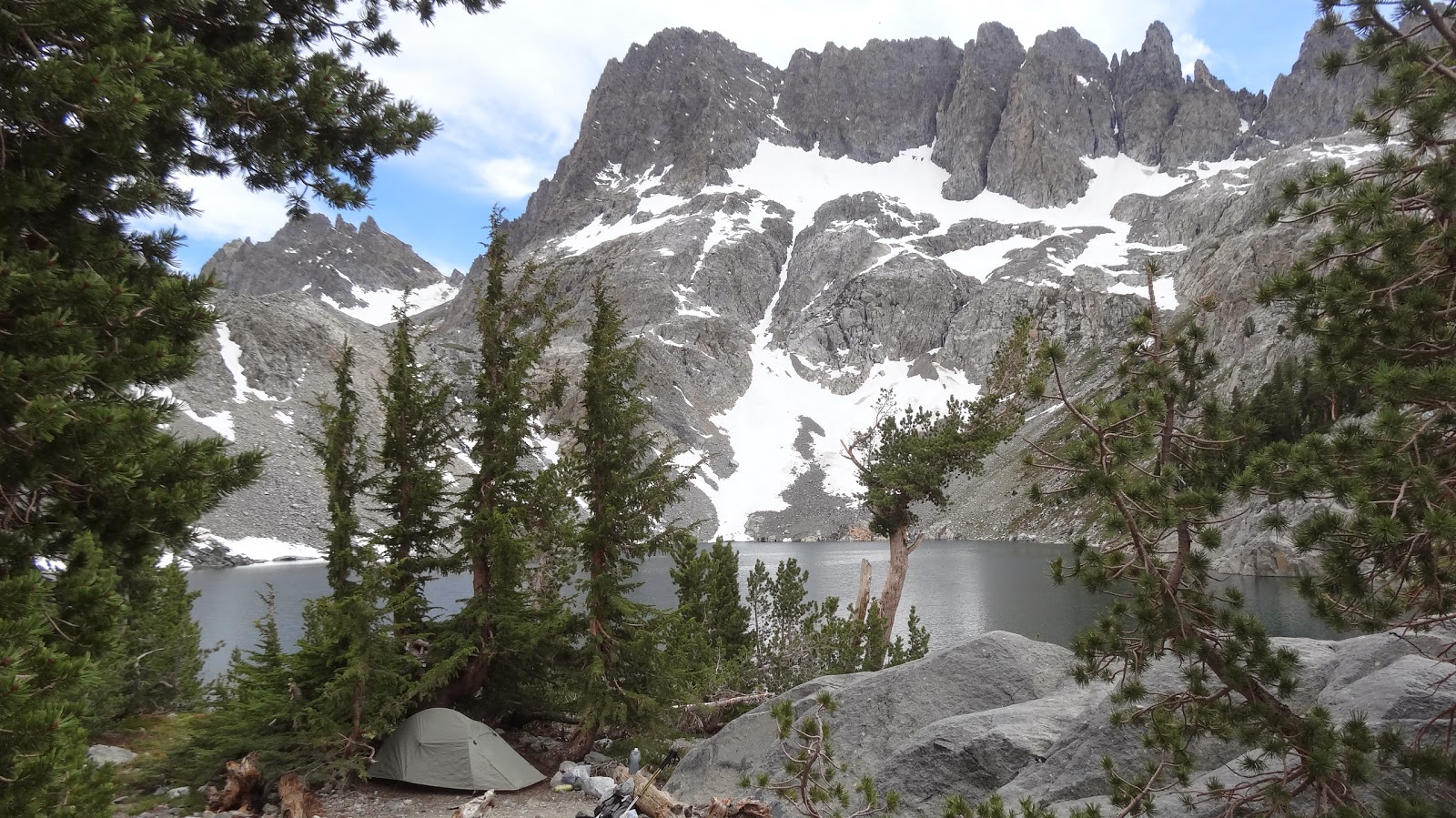 |
| My camp at Iceberg Lake, July 2015. Don't ruin a beautiful backpacking trip with a heavy pack! |
Consider a recent desert trip I did. I consumed 7 liters of water from the time I left one water source until I reached the next about 24 hours later. A liter weighs 2.2 pounds, so 7 liters weighs 15.4 pounds. So let's say I have a 15 lbs base weight, and I'm carrying 10 lbs of food (five days worth), and say 1/2 lbs of fuel. I'm now at 41 lbs which is a fairly heavy backpack to be lugging over mountainous desert terrain. And what if I had come to water after 48 hours instead of just 24? Now we're talking about a 56+ lbs backpack. And so on, and so on... The point is that even if you have a low base weight, you can still wind up with a heavy pack, depending on the length of a trip and the availability of water.
 |
| Tunnel Spring on the Desert Divide in the San Jacinto Mountains. It looks pretty gross, but we wouldn't see water again until the evening of the following day. We tanked up and were grateful. |
So you have to consider the overall weight of your pack. I mean you have to be physically able to carry the dang thing, and oh yes, we'd like to be able to enjoy ourselves at the same time.
OK, great, but what's our framework for judging whether or not a particular pack weight is appropriate? Good question. I'd like to propose the following schema, a schema based on total pack weight as a proportion of one's body weight:
The idea here is that what a 200 lbs 6'0" tall person might call light is not the same as what a 150 lbs 5'6" person would call light. The weight that it will be comfortable for a given person to carry varies in proportion to their body weight.
 |
| A chart showing pack weights as a proportion of one's body weight and the perceived weight category. |
My experience is that most reasonably fit people who have a decent amount of hiking experience will find a total pack weight equal to 1/6th of their body weight as a "moderate" backpack. In other words, most reasonably fit hikers can handle a pack that weighs about 1/6th of their own weight. It won't be easy, people won't remark "oh, it's as light as a feather," but people can handle it and still have a reasonably enjoyable time.
Now, a lot of books will suggest 1/3rd of your body weight as an upper limit. One-third? Really? I weigh 220 lbs. 1/3 of my body weight is about 73 pounds! Like I'm really going to hike with 73 freaking pounds on my back! Not happening. Now, really fit, really strong people can do it I'm sure, and a lot of hard core mountaineers probably do it all the time, but for the average hiker that I've met, no, 1/3rd is completely unrealistic. Take a look at the photo below. That's what 1/3rd of one's body weight looks like. Yes, it can be done, but isn't any fun, and in fact I've never been so exhausted in all my life as when I've had to carry not only a heavy pack but also my daughter. Again, for most hikers, 1/6th of your body weight is a desireable pack weight to shoot for. My recommendation is DON'T exceed 1/6th of your body weight unless you're an experienced backpacker who is getting out regularly and has worked up to carrying greater (proportionally) weights.
 |
| The author, carrying approximately 1/3rd of his body weight. It can be done, but it isn't fun. |
Now, is even lighter than 1/6th of one's own body weight more comfortable? Of course. I'm proposing 1/6th as a reasonably comfortable upper limit. If you can figure out ways to carry even less, by all means you should do so (so long as you are still reasonably safe and comfortable).
Indeed, if you've read any of my recent posts, they're all about trying to go from carrying a pack that weighs about 1/6th of my body weight to one that weighs about 1/8th of my body weight.
Lastly, if you look at the chart, you'll see some categories like "Extremely heavy," "very heavy," "moderate," "light," etc. Don't get too hung up on the exact category. The idea is to suggest where along the continuum most people will perceive a particular pack weight at a given proportion of their body weight. Obviously, proportions greater than 1/6th are some form of "heavy" whereas those that are less are some form of "light".
The idea here is not to set target categories but to stimulate thought. One should ask "What is my total pack weight going to be for the trip I'm planning?" and "is that weight a) realistic and b) reasonably comfortable?"
The idea here is not to set target categories but to stimulate thought. One should ask "What is my total pack weight going to be for the trip I'm planning?" and "is that weight a) realistic and b) reasonably comfortable?"
So, there you have it. While base weight is something to pay attention to, one should also keep in mind one's total pack weight. My recommendation is that total pack weight generally should be no more than 1/6th of one's body weight – at least until one has the experience to know otherwise.
I invite your reflections and comments, below.
HJ
Saturday, May 30, 2015
Sierra Nevada Summer Backpacking Solo Gear List - Version II
This is 4th is a series on backpacking base weight reduction.
Now, 34 lbs/15.4 kg is doable, but I know I'll be a lot happier if I can move down into the "light" category, particularly since my plan is to ascend to 14,500'/4400m in elevation. No need to drag a lot of weight that high!
So, I've done my first pass in lightening up my gear, and ... I've been able to cut 4.1 lbs off my gear! Huzzah! That moves me just below 30 lbs total pack weight, which would be great. I'd like to cut another couple of pounds off; we'll see. I hope to post a couple more versions before my trip in August, each lighter still. My current list is below my "signature". My comments on the current list:
First, I've swapped out my "sweater weight" down hoodie. Man! I love that thing, but it is a full pound. The down vest cuts that weight roughly in half. Now, will a vest (with no hood and no sleeves) be warm enough? We'll see. I'll have to keep a close eye on the weather as the trip approaches.
Likewise, I've swapped out my Capilene 2 top and bottom base layers for silk ones, saving over a quarter pound. Will these uber sheer silk ones be warm enough? Again, I'll have to watch the weather reports.
I've deleted any water treatment for this trip. Some people will think that's crazy, particularly if they've been reading the marketing spiel of the filter companies, but tests by an MD/PhD backpacker have shown the water in the Sierra to have less giardia than city water except in areas with heavy human use or livestock. I've gone without water treatment before in the Sierra, and I believe I'll be fine.
I've dropped my Isuka map case which I purchased in a mountain shop in Japan. That one sucks, because I really like that map case, but I'm going on well marked main trails, and I need to get the weight down. If I were doing off trail routes or sketchy trails, I would keep the case.
I've dropped spare batteries for my phone and camera. Instead I'll carry a single external battery and recharge my phone and camera as needed.
There are other changes, which are detailed below in the gear list, but the last major change I'll mention is swapping out my deluxe Stratospire I tarp tent for a minimalist Gatewood Cape. The Gatewood is not as weather proof, so I'll have to be really thinking in terms of site selection and such. One can use a "Serenity Bug Net" with the Gatewood Cape, but the Serenity Bug net is in my opinion poorly designed and really cuts down the interior volume of the cape unnecessarily, so I'll be leaving it behind. I could sleep in a head net, if needed, uber minimalism at its finest.
More to follow I'm sure, but here's where I am at today. I thank you for joining me.
TOTALS BY CATEGORY
- In my first post, A Gear List for Two, I listed out everything I carried for me and my daughter on a recent backpacking trip in Southern California, base weight 20.2 lbs (9.2 kg).
- In my second post, Lightweight Solo Backpacking Gear List for Southern California, I deleted out all of my daughter's items and created a solo gear list, base weight 15.2 lbs (6.9 kg).
- In my third post, Sierra Nevada Summer Backpacking Solo Gear List - Version I, I converted my Southern California gear list into a gear list for a week long trip in the Sierra Nevada Mountains, base weight 18.8 lbs (8.5 kg).
- This post is Version II of my Sierra Nevada Summer Backpacking Solo Gear List, base weight 14.7 lbs (6.7 kg).
- My next post will be Version III, contents yet to be determined, but with a base weight hopefully in the 13 pound range.
The weight gain in the Sierra Nevada version was primarily due to the addition of a bear canister, a mandatory item in the Sierra Nevada.
For a week trip in the Sierra, I figure I'm going to carry a dozen or so pounds of food, a couple of pounds of water, and about a pound of fuel, for a total weight of about 15 pounds (6.8 kg) for my consumables. Total pack weight = consumables + base weight, so with a consumables weight of 15 lbs and a base weight of essentially 19 lbs, my total pack weight would be 34 lbs (15.4 kg), placing me, a 220 lbs/100 kg person, in the "moderate" category based on a proportional weight schema as follows:
 |
| Lower Rae Lake in the Sierra Nevada Mountains, June 2014 |
| Proportional Total Pack Weight | |||||||||
| Ultra Heavy | Very Heavy | Heavy | Moderate | Light | Very Light | Ultra Light | Super Ultralight | Extremely Ultralight | |
| Body weight | 1/3rd | 1/4th | 1/5th | 1/6th | 1/8th | 1/10th | 1/12th | 1/15th | 1/20th |
| 225 | 75.0 | 56.3 | 45.0 | 37.5 | 28.1 | 22.5 | 18.8 | 15.0 | 11.3 |
| 220 | 73.3 | 55.0 | 44.0 | 36.7 | 27.5 | 22.0 | 18.3 | 14.7 | 11.0 |
| 200 | 66.7 | 50.0 | 40.0 | 33.3 | 25.0 | 20.0 | 16.7 | 13.3 | 10.0 |
| 175 | 58.3 | 43.8 | 35.0 | 29.2 | 21.9 | 17.5 | 14.6 | 11.7 | 8.8 |
| 150 | 50.0 | 37.5 | 30.0 | 25.0 | 18.8 | 15.0 | 12.5 | 10.0 | 7.5 |
| 125 | 41.7 | 31.3 | 25.0 | 20.8 | 15.6 | 12.5 | 10.4 | 8.3 | 6.3 |
| 100 | 33.3 | 25.0 | 20.0 | 16.7 | 12.5 | 10.0 | 8.3 | 6.7 | 5.0 |
 |
| Peaks in the Sierra Nevada Mountains. |
First, I've swapped out my "sweater weight" down hoodie. Man! I love that thing, but it is a full pound. The down vest cuts that weight roughly in half. Now, will a vest (with no hood and no sleeves) be warm enough? We'll see. I'll have to keep a close eye on the weather as the trip approaches.
Likewise, I've swapped out my Capilene 2 top and bottom base layers for silk ones, saving over a quarter pound. Will these uber sheer silk ones be warm enough? Again, I'll have to watch the weather reports.
I've deleted any water treatment for this trip. Some people will think that's crazy, particularly if they've been reading the marketing spiel of the filter companies, but tests by an MD/PhD backpacker have shown the water in the Sierra to have less giardia than city water except in areas with heavy human use or livestock. I've gone without water treatment before in the Sierra, and I believe I'll be fine.
I've dropped my Isuka map case which I purchased in a mountain shop in Japan. That one sucks, because I really like that map case, but I'm going on well marked main trails, and I need to get the weight down. If I were doing off trail routes or sketchy trails, I would keep the case.
I've dropped spare batteries for my phone and camera. Instead I'll carry a single external battery and recharge my phone and camera as needed.
There are other changes, which are detailed below in the gear list, but the last major change I'll mention is swapping out my deluxe Stratospire I tarp tent for a minimalist Gatewood Cape. The Gatewood is not as weather proof, so I'll have to be really thinking in terms of site selection and such. One can use a "Serenity Bug Net" with the Gatewood Cape, but the Serenity Bug net is in my opinion poorly designed and really cuts down the interior volume of the cape unnecessarily, so I'll be leaving it behind. I could sleep in a head net, if needed, uber minimalism at its finest.
More to follow I'm sure, but here's where I am at today. I thank you for joining me.
HJ
 |
| The author, backpacking in the Grand Canyon, May 2015 |
One Person Gear List
(Base Weight Only)
|
||||||||||||
| Sierra Nevada Mountains, Summer 2015, Day time high 80F/27C, Overnight low 40F/5C | ||||||||||||
| Category | Old Item | New Item | Old Grams | Old Ounces | Old Pounds | New Grams | New Ounces | New Pounds | Grams Saved | Ounces Saved | Pounds Saved | |
| 1 | Clothing | Patagonia down hoodie sweater | Eddie Bauer First Ascent Down Vest | 473 | 16.7 | 1.0 | 272 | 9.6 | 0.6 | 201 | 7.1 | 0.4 |
| 2 | Clothing | Long john top (Capilene 2) | Terramar silk long john top | 175 | 6.2 | 0.4 | 101 | 3.6 | 0.2 | 74 | 2.6 | 0.2 |
| 3 | Clothing | Long john bottom (Capilene 2) | Terramar silk long john bottom | 170 | 6.0 | 0.4 | 110 | 3.9 | 0.2 | 60 | 2.1 | 0.1 |
| 4 | Clothing | Flip flops | No change | 134 | 4.7 | 0.3 | 134 | 4.7 | 0.3 | 0 | 0.0 | 0.0 |
| 5 | Clothing | Golite wind pants | No change | 120 | 4.2 | 0.3 | 120 | 4.2 | 0.3 | 0 | 0.0 | 0.0 |
| 6 | Clothing | Fleece glove/mittens | No change | 100 | 3.5 | 0.2 | 100 | 3.5 | 0.2 | 0 | 0.0 | 0.0 |
| 7 | Clothing | Montane wind shirt | No change | 95 | 3.4 | 0.2 | 95 | 3.4 | 0.2 | 0 | 0.0 | 0.0 |
| 8 | Clothing | Underwear, 1 pair | No change | 90 | 3.2 | 0.2 | 90 | 3.2 | 0.2 | 0 | 0.0 | 0.0 |
| 9 | Clothing | socks, 1 pair, midweight | No change | 75 | 2.6 | 0.2 | 75 | 2.6 | 0.2 | 0 | 0.0 | 0.0 |
| 10 | Clothing | Ghost Whisperer shell | No change | 73 | 2.6 | 0.2 | 73 | 2.6 | 0.2 | 0 | 0.0 | 0.0 |
| 11 | Clothing | socks, 1 pair, midweight | Deleted | 68 | 2.4 | 0.1 | 0 | 0.0 | 0.0 | 68 | 2.4 | 0.1 |
| 12 | Clothing | Fleece hat | No change | 40 | 1.4 | 0.1 | 40 | 1.4 | 0.1 | 0 | 0.0 | 0.0 |
| 13 | Hydration | Steri Pen with batteries | Deleted | 123 | 4.3 | 0.3 | 0 | 0.0 | 0.0 | 123 | 4.3 | 0.3 |
| 14 | Hydration | 4 x Platypus bladder 1L | Only carry 2 x Playtypus bladder 1L | 100 | 3.5 | 0.2 | 50 | 1.8 | 0.1 | 50 | 1.8 | 0.1 |
| 15 | Hydration | Plastic "basin" (for Steri Pen treatment) | Deleted | 18 | 0.6 | 0.0 | 0 | 0.0 | 0.0 | 18 | 0.6 | 0.0 |
| 16 | Kitchen | Garcia Bear Canister | BV350 Bear Canister | 1280 | 45.2 | 2.8 | 923 | 32.6 | 2.0 | 357 | 12.6 | 0.8 |
| 17 | Kitchen | Trail Designs Ti-Tri Stove & 1.3 L Evernew UL Ti Pot | No change | 248 | 8.7 | 0.5 | 248 | 8.7 | 0.5 | 0 | 0.0 | 0.0 |
| 18 | Kitchen | GSI Plastic bowl | Ziploc plastic bowl | 45 | 1.6 | 0.1 | 26 | 0.9 | 0.1 | 19 | 0.7 | 0.0 |
| 19 | Kitchen | Titanium Sierra cup/measuring cup | No change | 43 | 1.5 | 0.1 | 43 | 1.5 | 0.1 | 0 | 0.0 | 0.0 |
| 20 | Kitchen | 12 fl oz (355 ml) alcohol bottle | No change | 39 | 1.4 | 0.1 | 39 | 1.4 | 0.1 | 0 | 0.0 | 0.0 |
| 21 | Kitchen | Sea to Summit Aluminum spoon | No change | 9 | 0.3 | 0.0 | 9 | 0.3 | 0.0 | 0 | 0.0 | 0.0 |
| 22 | Misc | AMK Optimist First Aid Kit (FAK) + 1 x roller gauze | No change | 244 | 8.6 | 0.5 | 244 | 8.6 | 0.5 | 0 | 0.0 | 0.0 |
| 23 | Misc | Personal Locator Beacon (PLB) | No change | 196 | 6.9 | 0.4 | 196 | 6.9 | 0.4 | 0 | 0.0 | 0.0 |
| 24 | Misc | External battery with mini cable | No change | 170 | 6.0 | 0.4 | 170 | 6.0 | 0.4 | 0 | 0.0 | 0.0 |
| 25 | Misc | Potty kit (TP + hand sanitizer) | No change | 136 | 4.8 | 0.3 | 136 | 4.8 | 0.3 | 0 | 0.0 | 0.0 |
| 26 | Misc | Map (topographic) and Isuka roll-up map case | Deleted | 111 | 3.9 | 0.2 | 0 | 0.0 | 0.0 | 111 | 3.9 | 0.2 |
| 27 | Misc | Glasses (distance only; Fresnel lens for reading) | No change | 109 | 3.8 | 0.2 | 109 | 3.8 | 0.2 | 0 | 0.0 | 0.0 |
| 28 | Misc | Misc Ziploc (chapstick, meds, matches, sewing kit, crazy glue, duct tape, tenacious tape) | No change | 105 | 3.7 | 0.2 | 105 | 3.7 | 0.2 | 0 | 0.0 | 0.0 |
| 29 | Misc | BP Bag (Cordage, Liquid soap, Thermarest patch kit, ear plugs) | No change | 100 | 3.5 | 0.2 | 100 | 3.5 | 0.2 | 0 | 0.0 | 0.0 |
| 30 | Misc | Spare phone batteries (2) | Deleted | 76 | 2.7 | 0.2 | 0 | 0.0 | 0.0 | 76 | 2.7 | 0.2 |
| 31 | Misc | Pouch (sunscreen, fire steel, tripod) Tripod weight, see below | No change | 74 | 2.6 | 0.2 | 74 | 2.6 | 0.2 | 0 | 0.0 | 0.0 |
| 32 | Misc | Mammut S-Flex headlamp | No change | 49 | 1.7 | 0.1 | 49 | 1.7 | 0.1 | 0 | 0.0 | 0.0 |
| 33 | Misc | Snow/sand stake (used as trowel and as tent stake) | No change | 35 | 1.2 | 0.1 | 35 | 1.2 | 0.1 | 0 | 0.0 | 0.0 |
| 34 | Misc | Dental Hygiene Kit (brush, paste, and floss) | No change | 30 | 1.1 | 0.1 | 30 | 1.1 | 0.1 | 0 | 0.0 | 0.0 |
| 35 | Misc | Mammut S-Flex headlamp case | No change | 28 | 1.0 | 0.1 | 28 | 1.0 | 0.1 | 0 | 0.0 | 0.0 |
| 36 | Misc | Spare camera battery | Deleted | 27 | 1.0 | 0.1 | 0 | 0.0 | 0.0 | 27 | 1.0 | 0.1 |
| 37 | Misc | Wilderness Permit in plastic Ziploc | No change | 18 | 0.6 | 0.0 | 18 | 0.6 | 0.0 | 0 | 0.0 | 0.0 |
| 38 | Misc | Spare Ziploc bag | No change | 9 | 0.3 | 0.0 | 9 | 0.3 | 0.0 | 0 | 0.0 | 0.0 |
| 39 | Misc | Trash bag | No change | 9 | 0.3 | 0.0 | 9 | 0.3 | 0.0 | 0 | 0.0 | 0.0 |
| 40 | Pack | Gossamer Gear Mariposa, Large | Cut off excess straps | 884 | 31.2 | 1.9 | 863 | 30.4 | 1.9 | 21 | 0.7 | 0.0 |
| 41 | Pack | Nylofume bag (as water proof liner) | No change | 30 | 1.1 | 0.1 | 30 | 1.1 | 0.1 | 0 | 0.0 | 0.0 |
| 42 | Photo | Camera with 1 battery | No change | 250 | 8.8 | 0.6 | 250 | 8.8 | 0.6 | 0 | 0.0 | 0.0 |
| 43 | Photo | Camera case | No change | 84 | 3.0 | 0.2 | 84 | 3.0 | 0.2 | 0 | 0.0 | 0.0 |
| 44 | Photo | Mini tripod | No change | 45 | 1.6 | 0.1 | 45 | 1.6 | 0.1 | 0 | 0.0 | 0.0 |
| 45 | Shelter | Stratospire I tarp tent with bug net inner (used for 2 ppl) | Gatewood Cape (no bug netting) | 1000 | 35.3 | 2.2 | 482 | 17.0 | 1.1 | 518 | 18.3 | 1.1 |
| 46 | Shelter | Tyvek ground sheet | No change | 130 | 4.6 | 0.3 | 130 | 4.6 | 0.3 | 0 | 0.0 | 0.0 |
| 47 | Shelter | 8 x "V" Al stakes (could save 1.5 oz with Ti stakes) | Stakes now incl. with Gatewood | 100 | 3.5 | 0.2 | 0 | 0.0 | 0.0 | 100 | 3.5 | 0.2 |
| 48 | Sleep | Western Mountaineering Summerlite 6'0" sleeping bag | No change | 580 | 20.5 | 1.3 | 580 | 20.5 | 1.3 | 0 | 0.0 | 0.0 |
| 49 | Sleep | NeoAir X-Lite 3/4 pad & stuff sack | No change | 240 | 8.5 | 0.5 | 240 | 8.5 | 0.5 | 0 | 0.0 | 0.0 |
| 50 | Sleep | Dry bag, 10L (holds both sleeping bag and down hoodie) | Silnylon stuff sack + Ziploc bag | 77 | 2.7 | 0.2 | 30 | 1.1 | 0.1 | 47 | 1.7 | 0.1 |
| 51 | Sleep | NeoAir Pillow & stuff sack | No change | 60 | 2.1 | 0.1 | 60 | 2.1 | 0.1 | 0 | 0.0 | 0.0 |
| Total | 8524 | 300.7 | 18.8 | 6654 | 234.7 | 14.7 | 1870 | 66.0 | 4.1 | |||
TOTALS BY CATEGORY
| Shelter | Sleep | Pack | Clothing | Kitchen | Photo | Hydration | Misc | |
| Grams | 612 | 910 | 893 | 1210 | 1288 | 379 | 50 | 1312 |
| Ounces | 21.6 | 32.1 | 31.5 | 42.7 | 45.4 | 13.4 | 1.8 | 46.3 |
| Pounds | 1.3 | 2.0 | 2.0 | 2.7 | 2.8 | 0.8 | 0.1 | 2.9 |
Subscribe to:
Posts (Atom)