Take a look at the below snippet of the USGS topographic map (San Jacinto Peak, 1:24,000). Click to enlarge.
 | |
| The spot elevation of 10,362' is positioned on the eastern portion of Marion Mountain's summit ridge. The manually drawn in black dot is the approximate position of the actual highest point on Marion Mountain on the western portion of the summit ridge. |
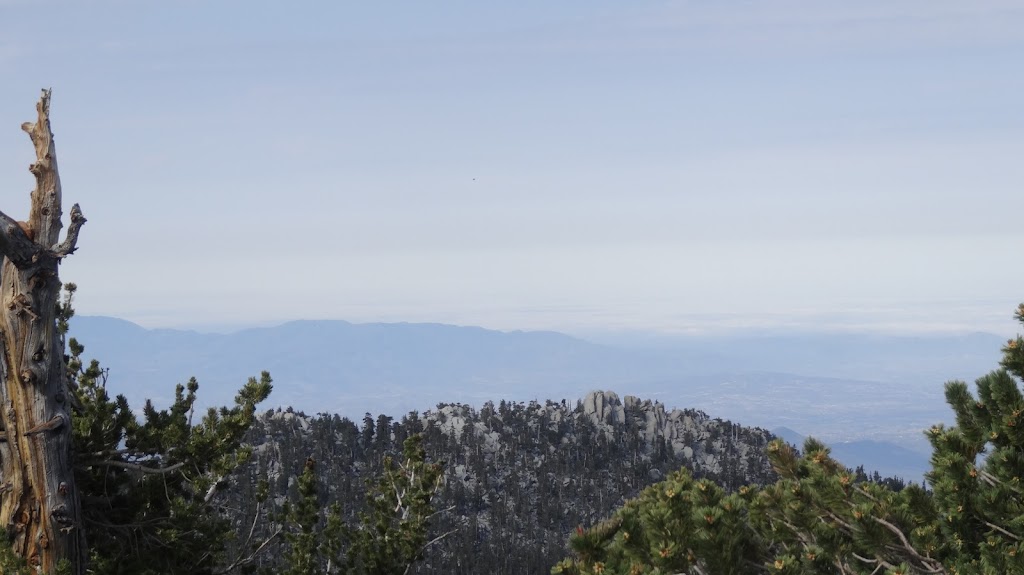
Now look at this photo of Marion Mountain, taken from Folly Peak. Note that the highest point appears to be on the western portion of the summit ridge.
 |
| Marion Mountain with directions indicated as shown |
Well, fortunately, I've climbed Marion Mountain a couple of times. The summit of Marion Mountain is quite obviously the highest point when you're standing atop it.
 |
| Summit bloc of Marion Mountain. Note climbing route arrows at bottom right of summit bloc. |
 |
| This vertical crack affords one a good class three route to the summit of Marion Mountain |
 |
| The summit of Marion Mountain. Final ascent route shown in red. |
 |
| Summit register signatures from several RMRU members. |
- I have personally climbed Marion Mountain. The highest point is distinctive and is unmistakably higher than any other point on the summit ridge.
- The highly distinctive summit cracks positively identify the high point.
- The summit register is positioned on the point I identify as the highest point.
- The HPS and RMRU accept the point I identify as the highest point.
Now, let's return to the question of the first photograph of the ridge I displayed, taken from Folly Peak which lies to the north. Does my first photo show the summit? My camera has a 20X optical zoom with another 20X in electronic zoom. Let's take a look at another photo shot from the vicinity of Folly Peak. In the photo, we can see once again the distinctive crack system on the summit bloc.
 | |
| Zoom photo of summit bloc of Marion Mountain as seen from Folly Peak. The distinctive cracks of Marion Mountain's summit are shown in red. |
So, what have I established?
- The spot elevation of 10,362' is NOT positioned on the highest point of Marion Mountain.
- Marion Mountain's summit is on the western portion of the summit ridge.
- Marion Mountain is clearly higher than 10,362'.
HJ
Appendix -- Further Photos of Marion Mountain
 |
| San Jacinto High Country from the highest point of Marion Mountain. It sure looks like Shirley Peak is lower than Marion Mountain. |
 |
| Marion Mountain from the flanks of Shirley Peak. Note that the highest point is the distinctive rock bloc and is on the western end of the summit ridge |
 |
| Another photo of Marion Mountain from Shirley Peak. Note that you can make out the large vertical crack in the summit bloc. |
 |
| Marion Mountain from Jean Peak. Note crack system in summit bloc and that summit bloc is clearly on the western end of the summit ridge. |
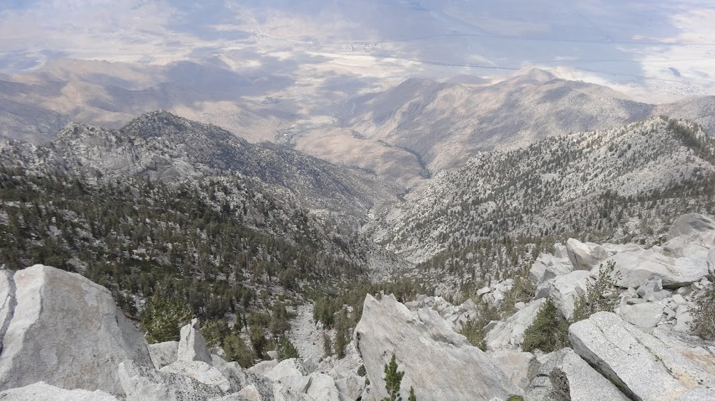 | |
| Part one of two parts. Snow Creek from west of the summit of San Jacinto Peak. Note large white dot down in the drainage to the left. |
 |
| Part two of two parts. Snow Creek from west of the summit of San Jacinto Peak. The white dot happens to be a sizeable water tank. My zoom really is good. |
 |
| San Jacinto high country as seen from vicinity the summit of Folly Peak. Note that the western portion of Marion Mountain is clearly higher that the eastern. |
 |
| Marion Mountain from Folly Peak |
 |
| Marion Mountain (horizon, slightly right of center) from Newton Drury Peak. Clearly, the western portion is higher than the eastern. |
Case closed. Hi. I am Phil Birkhahn. I hike with Nei. We noted the problem in September when we were on Shirley. Thanks for sorting this out. We went back in October and found the route to the true summit.
ReplyDeleteI can offer some perspective on the map because I worked for the USGS for 2 years. We were geologic mapping, which involved lots of interpretation of the maps prepared by the Topographic Division.
Placing peak names is one process and placing spot elevation is another. The workers did not necessarily confer and I do not know if the final review would catch the potential for confusion. Peak names are typically placed so that the closest letters are within one capital letter height of the peak. Separately, spot elevations are marked with an 'x' to give expression to the topography. The elevation is approximate and comes from the stereoscopic model created with aerial photographs.
Hi, Phil,
DeleteYour statement that peak names are placed one capital letter away from the high point of a peak is VERY interesting. That would basically corroborate what I'm asserting here in my blog post -- that the western summit is the true high point. Thanks so much for commenting.
HJ
Using the capital letter is not really a rule, its just way it works out graphically. I got out the old quads of the Sierras to check this out. The mountains are more pointy, making it clear where the high point is. After finding several peak names without spot elevations or benchmarks I think the capital letter dimension is a good rule of thumb.
ReplyDelete