The Snow Creek trailhead of the PCT is the northernmost entry point for hikers into the San Jacinto Mountains. This is a hot, desert area. Recommended season is November through April. Definitely not a good place to be on a hot day.
 |
| The San Jacinto Mountains from the Snow Creek trailhead of the PCT |
From Hwy 111 which connects Interstate 10 with Palm Springs, turn SW on Snow Creek Road (some maps list this road as "Snow Creek Canyon Road") and drive about 1.6 or 1.7 miles (2.6 or 2.7 km) to the intersection with Falls Creek Road. This is intersection is the trailhead. Google Map to the trailhead.
Out of respect for the residents of the private community of snow creek, make sure you park before the "Snow Creek Village" sign visible in the photo above. Across the street is another landmark, the "Snow Creek Wildlife Refuge" sign.
 |
| The "Snow Creek Wildlife Refuge" sign |
 |
| The PCT north bound from the Snow Creek trailhead |
 |
| The battered but still legible sign for Falls Creek Road |
 |
| DWA sign on Falls Creek Road |
Proceed on the paved road approximately one mile south until you come to "PCT Rock" at which point you will need to turn right.
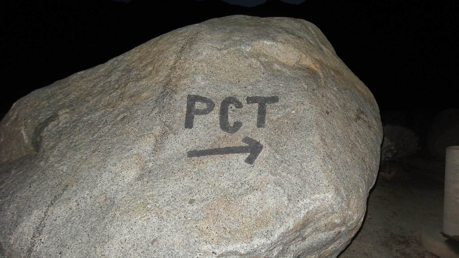 |
| "PCT Rock" |
 |
| The drinking fountain immediately west of PCT Rock |
It's a little creepy, but the DWA does have the area under camera surveillance. I suppose they do need to protect the water works. Anyway, just something to be aware of for the more modest among you.
 |
| Smile! You're on candid camera. |
As we leave the wonderful water fountain, this is where the real hiking begins. Whereas previously we were following a paved road, we are now on a dirt trail. My GPS track begins and ends at the water fountain: GPS Track, Snow Creek to Pt. 4460.
The first thing you come to is an old pipeline, presumably once used by the DWA to transport water. It now partially blocks the PCT. It's not too hard to squeeze around on the downhill side, but it does force you off the trail, so watch your step. I'm not sure why they couldn't do a better job of cutting the pipe to allow trail access.
 |
| Old pipeline partially blocking the PCT. |
 |
| Electrical cables strung across the PCT. |
 |
| Upper section (Section 33) of Snow Creek |
 |
| Water works, Snow Creek |
 |
| Various DWA structures in Snow Creek Canyon. Front, left: A garage/office/shop. Front, right: DWA caretaker's cabin. Rear: Large water tank with sun shelter in front housing what appears to be a generator. |
Glancing upwards, we can see the majestic outline of the high country of the San Jacinto Mountains. Indeed it is the mighty backdrop of the high country that makes the scenery here so compelling.
 |
| Sunrise, Snow Creek Canyon and San Jacinto Mountains from the PCT. |
 |
| Jumbo boulders near the PCT |
 |
| Snow Creek Village, from the PCT |
 |
| Brush across the PCT |
 |
| Potential camp site on the PCT. |
 |
| Wilderness boundary?? Hunh? What's this doing here? |
Soon after passing the post, we enter a drainage and encounter a small washout which is easily negotiated. We'll cross and re-cross this drainage four times on our trip today.
 |
| A wash out on the PCT |
 |
| The trailless wild of Falls Creek and Snow Creek |
 |
| Another washout on the PCT |
 |
| Mile 200 for one traveling north on the PCT |
 |
| Terrain in and around the W Fork of Snow Creek. |
 |
| Looking into the high country off the San Jacintos from the PCT |
 |
| A relatively benign slope south of point 4460 |
Cross Country Return Option
Now, what's the shortest distance between two points? A straight line of course. And what's the longest distance between two points? The PCT – or at least that's what most hikers will swear to who have hiked the PCT. Many sections of the PCT go for miles without really going anywhere. The PCT meanders out and around every little terrain feature which makes no sense at all until you understand that the builders were apparently paid by the mile. By the look of it, they went out of their way to make the trail as long as possible without overly arousing suspicions. In any event, it is just sometimes maddening how long the PCT takes to get anywhere.
It was growing late, so I took a quick look at the topo map and decided to cut straight down the drainage, the drainage I mentioned earlier that the PCT criss-crosses back and forth over repeatedly. This cross country route eliminates over two miles of the return trip. However, it's fairly rough terrain with brush and dry falls. I wouldn't recommend it unless you a) are willing to suffer b) like beating through brush, and c) like scrambling down loose rock and over dry water falls. Note that I don't think it actually saves any time since the going is so rough.
The crux of the route occurs in the upper most section of the route where the route drops over about a 30' dry falls. The falls is more of a rock jumble than a solid piece of rock. It's not too bad (class 3), but there is about a 6 foot overhanging section at the end that cannot be downclimbed. I tossed my pack down and jumped, a move not without risk.
 |
| This dry falls/rock jumble is the crux of the route |
 |
| A small pool in the drainage |
The drainage isn't easy going, but it is negotiable. Just a fun alternative for those crazy enough, err, skilled enough I mean, to try it.
 |
| Looking back up the drainage I just descended |
 |
| Charcoal marks on my hands and shirt. |
As I descended, I was taken by the rosey glow of the setting sun on the mountains to the north.
 |
| The fading light of the sun on the mountains north of San Gorgonio Pass. Note wind farm. |
Well, there you have it, a journey up the PCT and a cross country journey back. Thanks for coming along,
HJ
Appendix – Public vs. Private Land in Snow Creek
The area which is public land (under control of the San Bernadino National Forest) is legally defined as Township 3 South, Range 3 East, Section 28 (hereinafter just "Section 28"). The area that is private property is legally defined as Township 3 South, Range 3 East, Section 33 (hereinafter just "Section 33").
Now, if that sounds like a lot of surveyor mumbo-jumbo to you, you're not alone. To help you understand just where these sections of land are, I have drawn them in on the following map: Sections 28 and 33, Snow Creek, CA. You'll need to zoom in to make sense of the map, and you may want to toggle back and forth between the US Forest Service, Google map, and satellite views.
Basically, you should be able to go wherever you want in Section 28 on foot (motorized access is not permitted); it's all public land. You should stay out of Section 33. Falls Creek Road will take you into Section 33 if you go too far south. The DWA caretaker's cabin is just before the Section 33 boundary. Unless you have a GPS that you really trust to keep you out of Section 33, you shouldn't go south of the caretaker's cabin. I don't know that the boundary is marked, and the DWA could try to prosecute you for trespassing even though the boundary isn't marked.
Note: The DWA has a reputation for keeping people out of certain parts of Section 28, which is a violation of their lease. Section 28 is public land, and you have a right to pass so long as you do not interfere with the operation of the water works. If you are in any way harassed by the DWA (hopefully not; they should understand the terms of their lease), you should report the details of the harassment, preferably in writing, to the US Forest Service:
San Jacinto Ranger District, San Bernardino National Forest
Idyllwild Ranger Station
Attention: Ranger H. Hoggan
54270 Pine Crest Road / P.O. Box 518
Idyllwild, CA 92549
909-382-2945 office / 951-659-2107 fax
hhoggan [at] fs.fed.us
Again, though, hopefully everyone will play by the rules (including you), and there will be no trouble. Go where you like in Section 28, but stay out of Section 33. Simple enough, right?